Gumbinnen
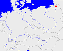
Diese Karte zeigt die Position oder den Umriss des Objekts. Haben Sie einen Fehler entdeckt? Dann würden wir uns über eine Nachricht freuen.
Übergeordnete Objekte
Legende
| | politische Verwaltung |
| | kirchliche Verwaltung |
| | gerichtliche Verwaltung |
| | Wohnplatz |
| | geographische Typen |
| | Verkehrswesen |
Übergeordnete Objekte
-
Preußen, Ostpreußen, Prusse orientale, Восточная Пруссия, Rytu Prusija, East Prussia, Prusy Zachodnie
(Provinz) (1808 - 1823)
-
Preußen
(Provinz) (1824 - 1877)
-
Preußen, Ostpreußen, Prusse orientale, Восточная Пруссия, Rytu Prusija, East Prussia, Prusy Zachodnie
(Provinz) (1878 - 1945)
Übergeordnete Objekte
| Name |
Zeitraum |
Typ |
Quelle |
|
Preußen, Ostpreußen, Prusse orientale, Восточная Пруссия, Rytu Prusija, East Prussia, Prusy Zachodnie
|
(1808 - 1823) |
Provinz
|
|
|
Preußen
|
(1824 - 1877) |
Provinz
|
|
|
Preußen, Ostpreußen, Prusse orientale, Восточная Пруссия, Rytu Prusija, East Prussia, Prusy Zachodnie
|
(1878 - 1945) |
Provinz
|
|
Untergeordnete Objekte
| Name |
Typ |
GOV-Kennung |
Zeitraum |
| Lötzen |
Kreis
Landkreis
|
object_190240 |
(1818-09-01 - 1905-10-31) |
| Ragnit |
Kreis
|
object_190258 |
(1818 - 1922-07-20) |
| Tilsit |
Stadtkreis
|
object_190261 |
(1896-04-01 - 1945) |
| Tilsit |
Kreis
Landkreis
|
adm_172788 |
(1818 - 1922-06-30) |
| Heydekrug, Šilutės apskritis |
Kreis
Landkreis
|
object_298739 |
(1939-05-01 - 1945) |
| Pogegen, Pagėgių apskritis |
Kreis
Landkreis
Kreis
|
object_217926 |
(1939-03-22 - 1939-09-30) |
| Insterburg |
Kreis
Landkreis
|
adm_172789 |
(- 1945) |
| Insterburg |
Stadtkreis
|
object_190255 |
(1901-05-01 - 1945) |
| Tilsit-Ragnit |
Kreis
Landkreis
|
object_275296 |
(1922-07-21 - 1945) |
| Memel, Klaipėdos miestas, Klaipėdos miesto savivaldybė |
Stadt
Stadtkreis
Stadt
Stadtgemeinde
|
object_218110 |
(1939-03-22 - 1945) |
| Gumbinnen |
Kreis
Landkreis
|
object_190253 |
(- 1945) |
| Pillkallen, Schloßberg (Ostpr.) |
Kreis
Landkreis
|
object_190257 |
(- 1945) |
| Memel, Klaipėdos apskritis |
Kreis
Landkreis
|
object_213956 |
(1939 - 1945) |
| Lyck |
Kreis
Landkreis
|
object_190241 |
(1818-09-01 - 1905-10-31) |
| Oletzko, Treuburg |
Landkreis
|
object_190243 |
(1818-09-01 - 1945) |
| Angerburg |
Kreis
Landkreis
|
object_1069558 |
(- 1945) |
| Angerburg |
Kreis
Landkreis
|
adm_172800 |
(1818-09-01 - 1945) |
| Johannisburg |
Kreis
Landkreis
|
adm_172700 |
(1818-09-01 - 1905-10-31) |
| Sensburg |
Kreis
Landkreis
|
object_190246 |
(- 1905-10-31) |
| Niederung, Elchniederung |
Kreis
Landkreis
|
object_190256 |
(- 1945) |
| Stallupönen, Ebenrode |
Kreis
Landkreis
|
object_190259 |
(1818-09-01 - 1945) |
| Heydekrug |
Kreis
Landkreis
|
adm_157700 |
(1939 - 1945) |
| Heydekrug |
Kreis
Landkreis
|
adm_157700 |
(1818 - 1920) |
| Darkehmen, Angerapp |
Kreis
Landkreis
|
object_190251 |
(- 1945) |
| Goldap |
Kreis
Landkreis
|
object_190252 |
(1818-09-01 - 1945) |
Bilder im GenWiki
Quicktext
adm_368498
	gehört ab 1808 bis 1823 zu adm_368500,
	gehört ab 1824 bis 1877 zu object_1281054,
	gehört ab 1878 bis 1945 zu adm_368500,
	hat 1880-12-01 Einwohner 778391 sagt source_1343683 (Tab. II S. 16),
	hat 1880-12-01 Fläche 15870.39 sagt source_1343683 (Tab. III S. 26),
	hat 1890-12-01 Einwohner 786514 sagt source_1343682 (Tab. II S. 18),
	hat 1890-12-01 Fläche 15877.49 sagt source_1343682 (Tab. III S. 24),
	hat 1900 Fläche 15877.49 sagt source_319222 (Bd 8 S.90),
	hat 1900-12-01 Einwohner 792240 sagt source_1343684 (Tab. I S. 2),
	hat 1900-12-01 Fläche 15885.72 sagt source_1343684 (Tab. II S. 8),
	hat 1910-12-01 Einwohner 606587 sagt source_1341051 (Tab. II S. 8),
	hat 1910-12-01 Fläche 10965.54 sagt source_1341051 (Tab. II S. 8),
	hat 1925-06-16 Einwohner 539778 sagt source_1341056 (S. 44),
	hat 1925-06-16 Fläche 9397.02 sagt source_1341056 (S. 44),
	hat 1933-06-16 Einwohner 546057 sagt source_1267338 (S. 6),
	hat 1935-10-01 Fläche 9399.36 sagt source_1267338 (S. 6),
	hat 1939-05-17 Einwohner 713899 sagt source_298730 (S. 8 - ohne eingegl. Ostgebiete),
	hat 1941-01-01 Fläche 11817.52 sagt source_298730 (S. 8 - ohne eingegl. Ostgebiete),
	heißt  (auf deu) Gumbinnen,
	ist (auf deu) Regierungsbezirk;

