Wissowatten, Wyszowate
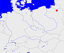
Diese Karte zeigt die Position oder den Umriss des Objekts. Haben Sie einen Fehler entdeckt? Dann würden wir uns über eine Nachricht freuen.
Übergeordnete Objekte
Legende
| | politische Verwaltung |
| | kirchliche Verwaltung |
| | gerichtliche Verwaltung |
| | Wohnplatz |
| | geographische Typen |
| | Verkehrswesen |
Übergeordnete Objekte
- Wissowatten (Landgemeinde Gemeinde)
- Lötzen (Kreis Landkreis)
- Allenstein (Regierungsbezirk)
- Preußen, Ostpreußen, Prusse orientale, East Prussia, Rytu Prusija, Восточная Пруссия, Prusy Zachodnie (Provinz)
- Preußen, Pruisen, Pruissen (Herzogtum Königreich Freistaat)
- Deutscher Bund, German Confederation (Staatenbund)
- Norddeutscher Bund (Staatenbund Bundesstaat)
- Deutsches Reich, German Empire, Duitse Rijk (Bundesstaat)
- Völkerbund, Société des Nations, League of Nations, Sociedad de Naciones, Folkeforbundet, 國際聯盟, Liga Narodów, Volkenbond, 国際連盟, Società delle Nazioni, Milletler Cemiyeti, Sociedade das Nações (Staatenbund)
- Gumbinnen (Regierungsbezirk)
- Preußen, Ostpreußen, Prusse orientale, East Prussia, Rytu Prusija, Восточная Пруссия, Prusy Zachodnie (Provinz)
- Preußen, Pruisen, Pruissen (Herzogtum Königreich Freistaat)
- Deutscher Bund, German Confederation (Staatenbund)
- Norddeutscher Bund (Staatenbund Bundesstaat)
- Deutsches Reich, German Empire, Duitse Rijk (Bundesstaat)
- Völkerbund, Société des Nations, League of Nations, Sociedad de Naciones, Folkeforbundet, 國際聯盟, Liga Narodów, Volkenbond, 国際連盟, Società delle Nazioni, Milletler Cemiyeti, Sociedade das Nações (Staatenbund)
- Preußen, Pruisen, Pruissen (Herzogtum Königreich Freistaat)
- Deutscher Bund, German Confederation (Staatenbund)
- Norddeutscher Bund (Staatenbund Bundesstaat)
- Deutsches Reich, German Empire, Duitse Rijk (Bundesstaat)
- Völkerbund, Société des Nations, League of Nations, Sociedad de Naciones, Folkeforbundet, 國際聯盟, Liga Narodów, Volkenbond, 国際連盟, Società delle Nazioni, Milletler Cemiyeti, Sociedade das Nações (Staatenbund)
- Preußen (Provinz)
- Preußen, Pruisen, Pruissen (Herzogtum Königreich Freistaat)
- Deutscher Bund, German Confederation (Staatenbund)
- Norddeutscher Bund (Staatenbund Bundesstaat)
- Deutsches Reich, German Empire, Duitse Rijk (Bundesstaat)
- Völkerbund, Société des Nations, League of Nations, Sociedad de Naciones, Folkeforbundet, 國際聯盟, Liga Narodów, Volkenbond, 国際連盟, Società delle Nazioni, Milletler Cemiyeti, Sociedade das Nações (Staatenbund)
- Województwo suwalskie (Wojewodschaft)
- Polen (Dritte Republik), Polen, La Pologne - IIIe République, Polska - III Rzeczpospolita, Polaca - Tercera República, Третья Речь Посполитая, Poland (Third Republic) (Republik)
- Europäische Wirtschaftsgemeinschaft, Europäische Gemeinschaft, Europäische Union, Comhphobal Eacnamaíochta na hEorpa, Euroopan talousyhteisö, Európske hospodárske spoločenstvo, Communauté économique européenne, Comunidad Económica Europea, European Economic Community, Evropské hospodářské společenství, Europese Economische Gemeenschap, Comunità Economica Europea, Európske spoločenstvo, Europese Gemeenschap, Euroopan Yhteisö, European Community, Evropské společenství, Communauté européenne, Comhphobal Eorpach, Comunidad Europea, Comunità Europea, Európska únia, Europese Unie, Aontais Eorpaigh, European Union, Unión Europea, Euroopan Unioni, Evropská unie, Union européenne, Unione Europea (Staatenbund)
- Vereinte Nationen, Organización de las Naciones Unidas, Organisation des Nations unies, 联合国, Организация Объединённых Наций, الأمم المتحدة, United Nations, Verenigde Naties, Organizácia Spojených národov (Staatenbund)
- Polen, República Popular de Polonia, Польская Народная Республика, Lenkijos Liaudies Respublika, La Pologne - République populaire, Poland - People's Republic, Polen, Rzeczpospolita Polska, Polska Rzeczpospolita Ludowa (Republik Volksrepublik)
- Miłki (Landgemeinde PL)
- Powiat giżycki (Landkreis)
- Województwo olsztyńskie (Wojewodschaft)
- Polen, República Popular de Polonia, Польская Народная Республика, Lenkijos Liaudies Respublika, La Pologne - République populaire, Poland - People's Republic, Polen, Rzeczpospolita Polska, Polska Rzeczpospolita Ludowa (Republik Volksrepublik)
- Polen (Dritte Republik), Polen, La Pologne - IIIe République, Polska - III Rzeczpospolita, Polaca - Tercera República, Третья Речь Посполитая, Poland (Third Republic) (Republik)
- Europäische Wirtschaftsgemeinschaft, Europäische Gemeinschaft, Europäische Union, Comhphobal Eacnamaíochta na hEorpa, Euroopan talousyhteisö, Európske hospodárske spoločenstvo, Communauté économique européenne, Comunidad Económica Europea, European Economic Community, Evropské hospodářské společenství, Europese Economische Gemeenschap, Comunità Economica Europea, Európske spoločenstvo, Europese Gemeenschap, Euroopan Yhteisö, European Community, Evropské společenství, Communauté européenne, Comhphobal Eorpach, Comunidad Europea, Comunità Europea, Európska únia, Europese Unie, Aontais Eorpaigh, European Union, Unión Europea, Euroopan Unioni, Evropská unie, Union européenne, Unione Europea (Staatenbund)
- Vereinte Nationen, Organización de las Naciones Unidas, Organisation des Nations unies, 联合国, Организация Объединённых Наций, الأمم المتحدة, United Nations, Verenigde Naties, Organizácia Spojených národov (Staatenbund)
- Talki (Landgemeinde PL)
- Powiat giżycki (Landkreis)
- Województwo olsztyńskie (Wojewodschaft)
- Polen, República Popular de Polonia, Польская Народная Республика, Lenkijos Liaudies Respublika, La Pologne - République populaire, Poland - People's Republic, Polen, Rzeczpospolita Polska, Polska Rzeczpospolita Ludowa (Republik Volksrepublik)
- Polen (Dritte Republik), Polen, La Pologne - IIIe République, Polska - III Rzeczpospolita, Polaca - Tercera República, Третья Речь Посполитая, Poland (Third Republic) (Republik)
- Europäische Wirtschaftsgemeinschaft, Europäische Gemeinschaft, Europäische Union, Comhphobal Eacnamaíochta na hEorpa, Euroopan talousyhteisö, Európske hospodárske spoločenstvo, Communauté économique européenne, Comunidad Económica Europea, European Economic Community, Evropské hospodářské společenství, Europese Economische Gemeenschap, Comunità Economica Europea, Európske spoločenstvo, Europese Gemeenschap, Euroopan Yhteisö, European Community, Evropské společenství, Communauté européenne, Comhphobal Eorpach, Comunidad Europea, Comunità Europea, Európska únia, Europese Unie, Aontais Eorpaigh, European Union, Unión Europea, Euroopan Unioni, Evropská unie, Union européenne, Unione Europea (Staatenbund)
- Vereinte Nationen, Organización de las Naciones Unidas, Organisation des Nations unies, 联合国, Организация Объединённых Наций, الأمم المتحدة, United Nations, Verenigde Naties, Organizácia Spojených národov (Staatenbund)
- Wyszowate (Schulzenamt)
- Miłki (Landgemeinde PL)
- Powiat giżycki (Landkreis)
- Województwo warmińsko-mazurskie (Wojewodschaft)
- Polen (Dritte Republik), Polen, La Pologne - IIIe République, Polska - III Rzeczpospolita, Polaca - Tercera República, Третья Речь Посполитая, Poland (Third Republic) (Republik)
- Europäische Wirtschaftsgemeinschaft, Europäische Gemeinschaft, Europäische Union, Comhphobal Eacnamaíochta na hEorpa, Euroopan talousyhteisö, Európske hospodárske spoločenstvo, Communauté économique européenne, Comunidad Económica Europea, European Economic Community, Evropské hospodářské společenství, Europese Economische Gemeenschap, Comunità Economica Europea, Európske spoločenstvo, Europese Gemeenschap, Euroopan Yhteisö, European Community, Evropské společenství, Communauté européenne, Comhphobal Eorpach, Comunidad Europea, Comunità Europea, Európska únia, Europese Unie, Aontais Eorpaigh, European Union, Unión Europea, Euroopan Unioni, Evropská unie, Union européenne, Unione Europea (Staatenbund)
- Vereinte Nationen, Organización de las Naciones Unidas, Organisation des Nations unies, 联合国, Организация Объединённых Наций, الأمم المتحدة, United Nations, Verenigde Naties, Organizácia Spojených národov (Staatenbund)
- Wyszowate (Gromada)
- Powiat giżycki (Landkreis)
- Województwo olsztyńskie (Wojewodschaft)
- Polen, República Popular de Polonia, Польская Народная Республика, Lenkijos Liaudies Respublika, La Pologne - République populaire, Poland - People's Republic, Polen, Rzeczpospolita Polska, Polska Rzeczpospolita Ludowa (Republik Volksrepublik)
- Polen (Dritte Republik), Polen, La Pologne - IIIe République, Polska - III Rzeczpospolita, Polaca - Tercera República, Третья Речь Посполитая, Poland (Third Republic) (Republik)
- Europäische Wirtschaftsgemeinschaft, Europäische Gemeinschaft, Europäische Union, Comhphobal Eacnamaíochta na hEorpa, Euroopan talousyhteisö, Európske hospodárske spoločenstvo, Communauté économique européenne, Comunidad Económica Europea, European Economic Community, Evropské hospodářské společenství, Europese Economische Gemeenschap, Comunità Economica Europea, Európske spoločenstvo, Europese Gemeenschap, Euroopan Yhteisö, European Community, Evropské společenství, Communauté européenne, Comhphobal Eorpach, Comunidad Europea, Comunità Europea, Európska únia, Europese Unie, Aontais Eorpaigh, European Union, Unión Europea, Euroopan Unioni, Evropská unie, Union européenne, Unione Europea (Staatenbund)
- Vereinte Nationen, Organización de las Naciones Unidas, Organisation des Nations unies, 联合国, Организация Объединённых Наций, الأمم المتحدة, United Nations, Verenigde Naties, Organizácia Spojených národov (Staatenbund)
- Milken (Kirchspiel)
- Lyck, Lyck (St. Adalbert), Ełk (Św. Wojciecha) (Pfarrei)
- Lötzen (St. Bruno), Lötzen, Giżycko (Św. Brunona Biskupa i Męczennika) (Pfarrei)
- Milken (Standesamt)
- Lötzen (Kreis Landkreis)
- Allenstein (Regierungsbezirk)
- Preußen, Ostpreußen, Prusse orientale, East Prussia, Rytu Prusija, Восточная Пруссия, Prusy Zachodnie (Provinz)
- Preußen, Pruisen, Pruissen (Herzogtum Königreich Freistaat)
- Deutscher Bund, German Confederation (Staatenbund)
- Norddeutscher Bund (Staatenbund Bundesstaat)
- Deutsches Reich, German Empire, Duitse Rijk (Bundesstaat)
- Völkerbund, Société des Nations, League of Nations, Sociedad de Naciones, Folkeforbundet, 國際聯盟, Liga Narodów, Volkenbond, 国際連盟, Società delle Nazioni, Milletler Cemiyeti, Sociedade das Nações (Staatenbund)
- Preußen, Pruisen, Pruissen (Herzogtum Königreich Freistaat)
- Deutscher Bund, German Confederation (Staatenbund)
- Norddeutscher Bund (Staatenbund Bundesstaat)
- Deutsches Reich, German Empire, Duitse Rijk (Bundesstaat)
- Völkerbund, Société des Nations, League of Nations, Sociedad de Naciones, Folkeforbundet, 國際聯盟, Liga Narodów, Volkenbond, 国際連盟, Società delle Nazioni, Milletler Cemiyeti, Sociedade das Nações (Staatenbund)
- Gumbinnen (Regierungsbezirk)
- Preußen, Ostpreußen, Prusse orientale, East Prussia, Rytu Prusija, Восточная Пруссия, Prusy Zachodnie (Provinz)
- Preußen, Pruisen, Pruissen (Herzogtum Königreich Freistaat)
- Deutscher Bund, German Confederation (Staatenbund)
- Norddeutscher Bund (Staatenbund Bundesstaat)
- Deutsches Reich, German Empire, Duitse Rijk (Bundesstaat)
- Völkerbund, Société des Nations, League of Nations, Sociedad de Naciones, Folkeforbundet, 國際聯盟, Liga Narodów, Volkenbond, 国際連盟, Società delle Nazioni, Milletler Cemiyeti, Sociedade das Nações (Staatenbund)
- Preußen, Pruisen, Pruissen (Herzogtum Königreich Freistaat)
- Deutscher Bund, German Confederation (Staatenbund)
- Norddeutscher Bund (Staatenbund Bundesstaat)
- Deutsches Reich, German Empire, Duitse Rijk (Bundesstaat)
- Völkerbund, Société des Nations, League of Nations, Sociedad de Naciones, Folkeforbundet, 國際聯盟, Liga Narodów, Volkenbond, 国際連盟, Società delle Nazioni, Milletler Cemiyeti, Sociedade das Nações (Staatenbund)
- Preußen, Ostpreußen, Prusse orientale, East Prussia, Rytu Prusija, Восточная Пруссия, Prusy Zachodnie (Provinz)
- Preußen, Pruisen, Pruissen (Herzogtum Königreich Freistaat)
- Deutscher Bund, German Confederation (Staatenbund)
- Norddeutscher Bund (Staatenbund Bundesstaat)
- Deutsches Reich, German Empire, Duitse Rijk (Bundesstaat)
- Völkerbund, Société des Nations, League of Nations, Sociedad de Naciones, Folkeforbundet, 國際聯盟, Liga Narodów, Volkenbond, 国際連盟, Società delle Nazioni, Milletler Cemiyeti, Sociedade das Nações (Staatenbund)
- Preußen, Pruisen, Pruissen (Herzogtum Königreich Freistaat)
- Deutscher Bund, German Confederation (Staatenbund)
- Norddeutscher Bund (Staatenbund Bundesstaat)
- Deutsches Reich, German Empire, Duitse Rijk (Bundesstaat)
- Völkerbund, Société des Nations, League of Nations, Sociedad de Naciones, Folkeforbundet, 國際聯盟, Liga Narodów, Volkenbond, 国際連盟, Società delle Nazioni, Milletler Cemiyeti, Sociedade das Nações (Staatenbund)
- Preußen (Provinz)
- Preußen, Pruisen, Pruissen (Herzogtum Königreich Freistaat)
- Deutscher Bund, German Confederation (Staatenbund)
- Norddeutscher Bund (Staatenbund Bundesstaat)
- Deutsches Reich, German Empire, Duitse Rijk (Bundesstaat)
- Völkerbund, Société des Nations, League of Nations, Sociedad de Naciones, Folkeforbundet, 國際聯盟, Liga Narodów, Volkenbond, 国際連盟, Società delle Nazioni, Milletler Cemiyeti, Sociedade das Nações (Staatenbund)
Übergeordnete Objekte
Quicktext
WISTENKO03WW
	gehört ab 1785 bis 1945 zu object_164093 sagt source_299096 (S. 73.91) sagt source_810519 (S. 184),
	gehört ab 1818-02-01 bis 1945 zu object_1053984 sagt source_1054164 (S. 53.52) sagt source_299096 (S. 73.91),
	gehört ab 1853 bis 1910 zu object_291889 sagt source_190237 (S. 140.84),
	gehört ab 1874-10-01 bis 1945 zu object_1082399 sagt source_299096 (S. 73.91) sagt source_810126 (S. 362.85),
	gehört ab 1910 bis 1945 zu object_291887 sagt source_299096 (S. 73.91),
	gehört ab 1946-06-28 bis 1954 zu object_1082315 sagt source_1081932 (S. 178),
	gehört ab 1954 bis 1972-12-31 zu object_1082398 sagt source_1081932 (S. 178),
	gehört ab 1973-01-01 bis 1975 zu object_1082353 sagt source_299844 (Gmina Miłki),
	gehört ab 1975 bis 1998-12-31 zu object_214164 sagt source_299844 (Konopki Wielkie),
	gehört ab 1999-01-01 zu object_1082397 sagt source_1082355,
	hat 2014 PLZ PL-11-513 sagt source_1046232,
	hat externe Kennung  SIMC:0762780,
	hat w-Nummer 50333,
	heißt  (auf deu) Wissowatten sagt source_190237 (S. 140.84),
	heißt  (auf pol) Wyszowate sagt source_190269,
	ist ab 1785 bis 1945 (auf deu) Dorf sagt source_299096 (S. 73.91) sagt source_810519 (S. 184),
	ist ab 1945 (auf deu) Dorf sagt source_1045510,
	liegt bei 53.92222°N 21.88606°O;


